![]()
![]()
![]()
![]()
![]()
![]()
![]()
![]()
![]()
NATTC Maps and Aerial Photos
Maps and aerial photos will open in a separate window. This will allow the viewer to keep them open and toggle back and forth as a point of reference. Both maps and aerial photos are very large files and might take longer to download. This allows preservation of detail and allows the reader to zoom in and out for a closer look.
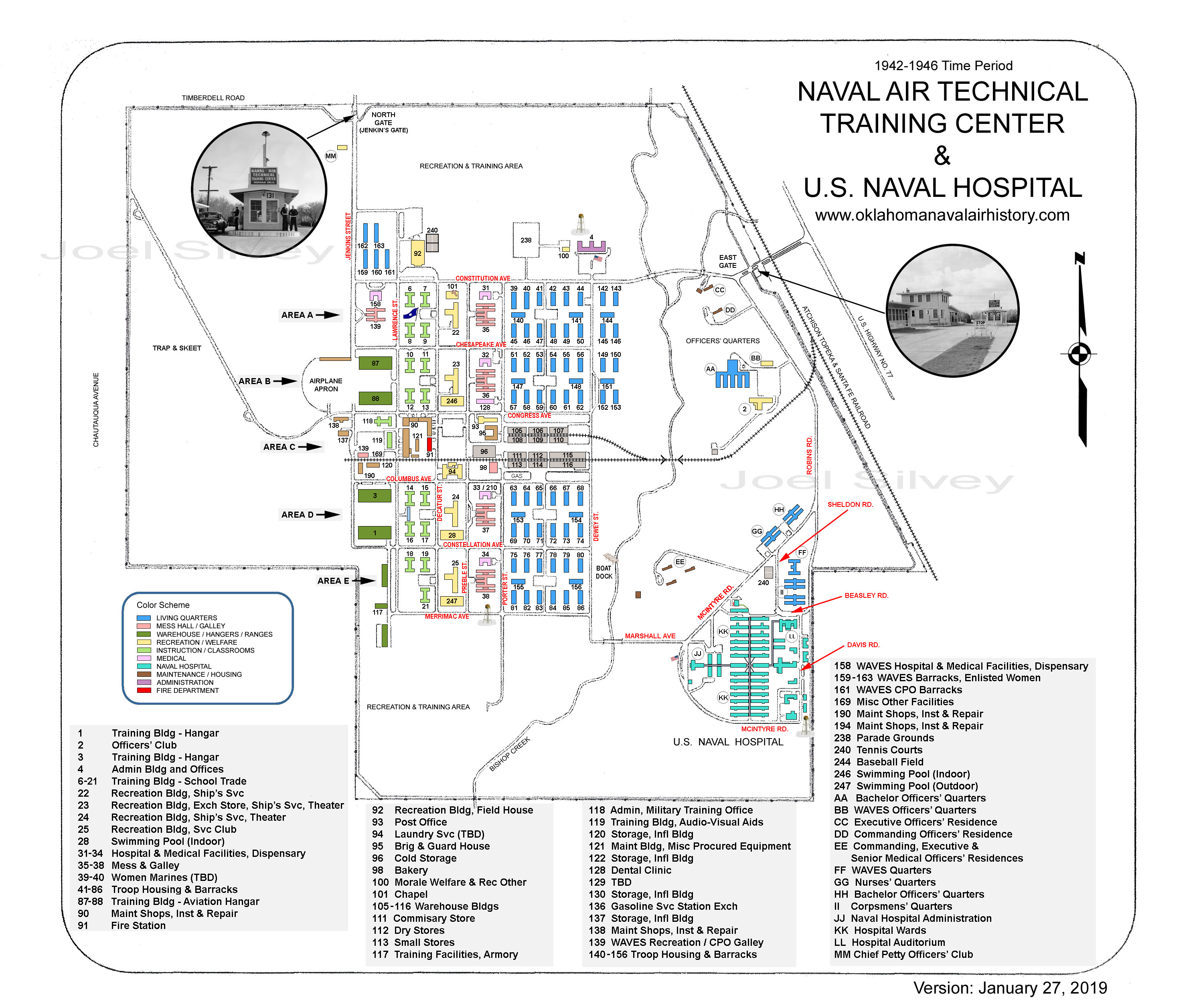
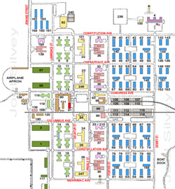
NATTC WWII Key Map
NATTC 1950's
To Be Added Soon
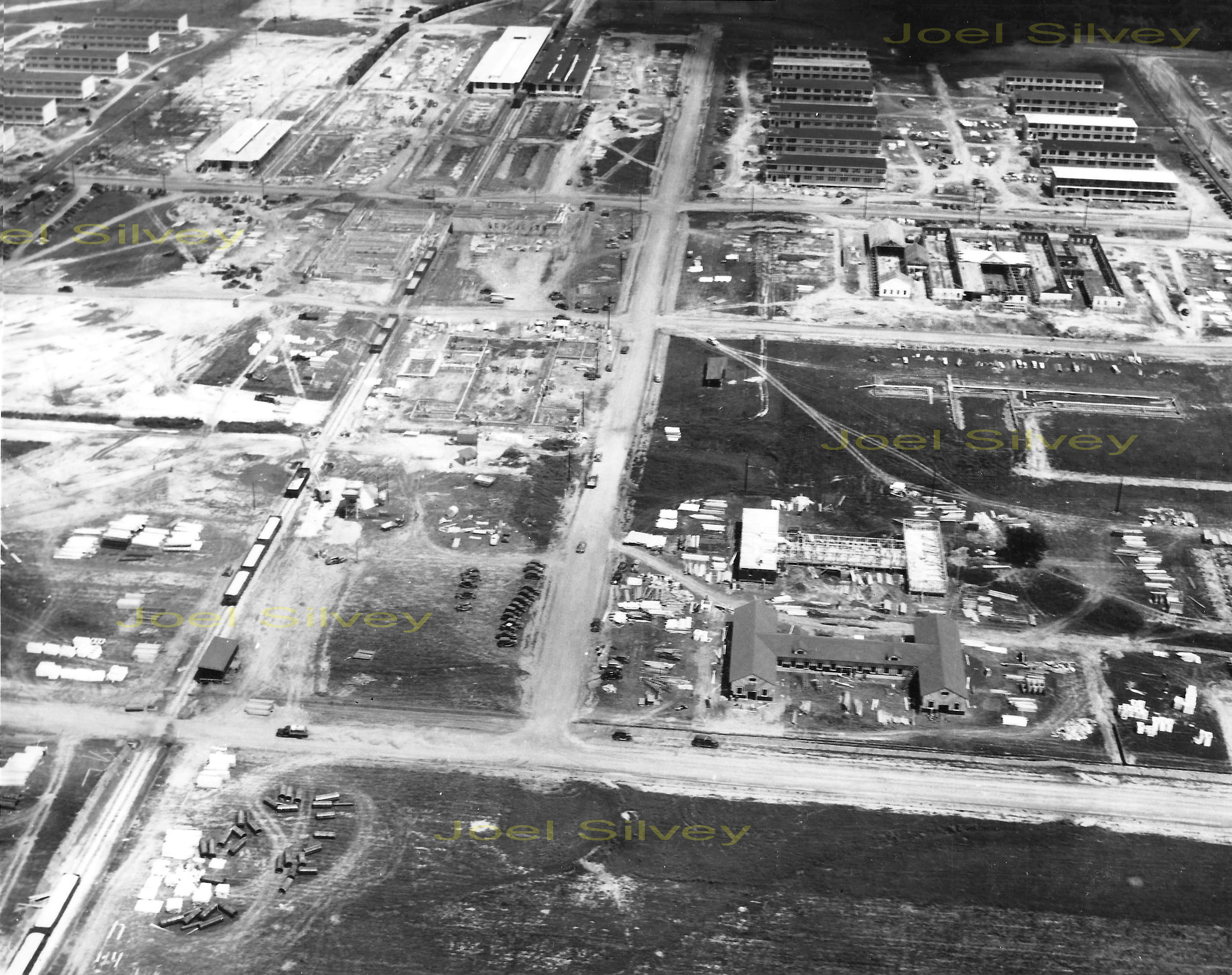
October 10, 1942 Front
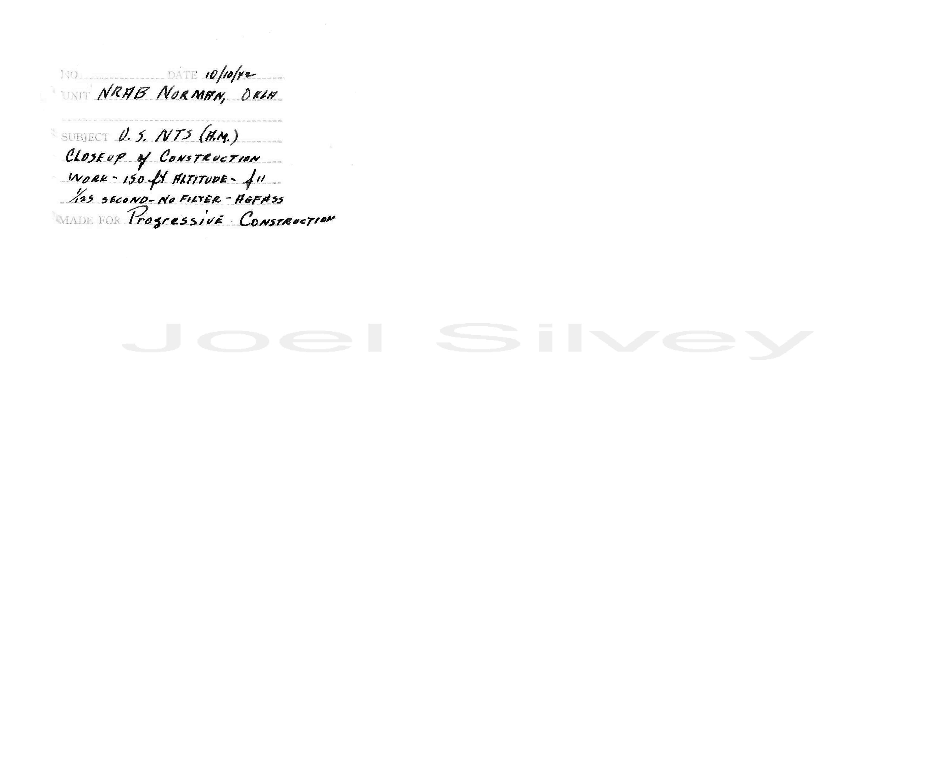
October 10, 1942 Back
This photo, dated October 10, 1942, was taken on the west side of NATTC looking east over Area C and Area D. Wartime urgency made it necessary to commission the Naval Training School long before construction was actually completed. The two I-shaped buildings visible near the front of the photo are Instruction Buildings 14 and 15. Immediately behind is the visible foundation lines of Recreation Building 24 and beyond the partially completed mess hall, Building 37. Barracks lie towards the back and most look to be completed. Many other building foundations are visible upon closer examination. Zoom in and you will see many automobiles of the time period. The base was built using civilian labor, those cars belong to them. This photo is one of my favorites from this project. There is just so much history tucked away in this photo. I discover something new everytime I examine it.
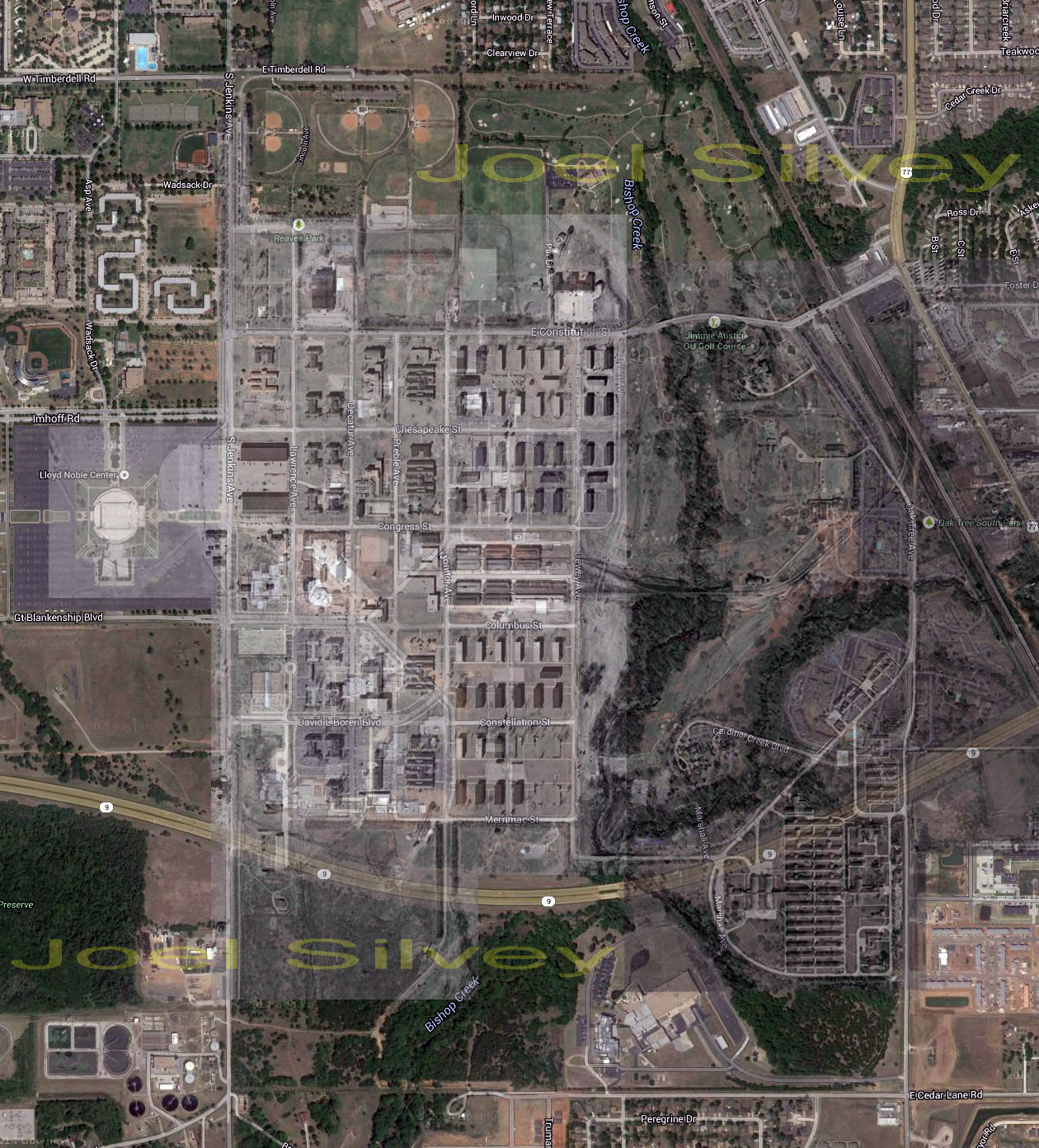
Vintage Aerial Overlay
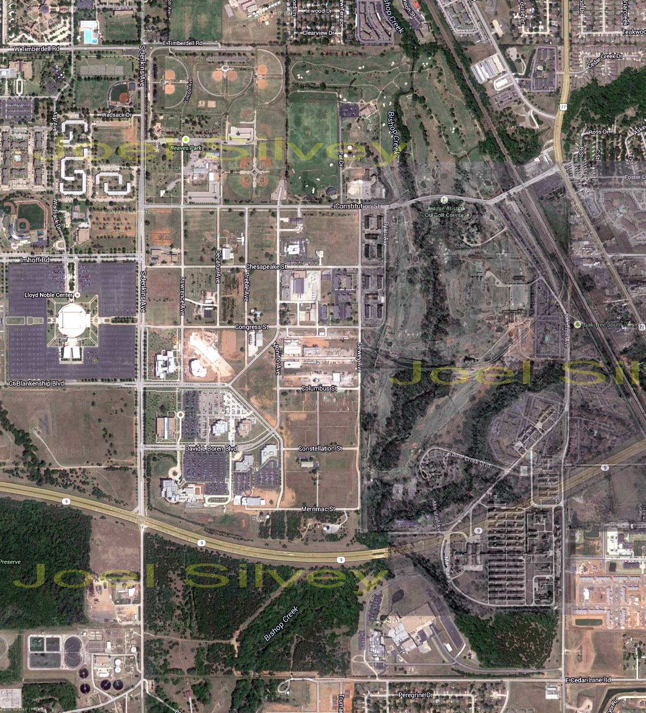
Hospital Only Overlay
Here is an interesting photo I created in Photoshop. It is a modern aerial photo combined with a vintage aerial photo overlay. Reducing the visibility of the vintage aerial photo resulted in a ghostly image of the past naval base / hospital in relation to the modern structures that exist there today. You can see quite clearly how Highway 9 cuts right through where the Naval Hospital was as well as the southern most gun-sighting range. The Lloyd Nobel is located on the west side of the Airplane Apron where the planes were parked that the students learned on.
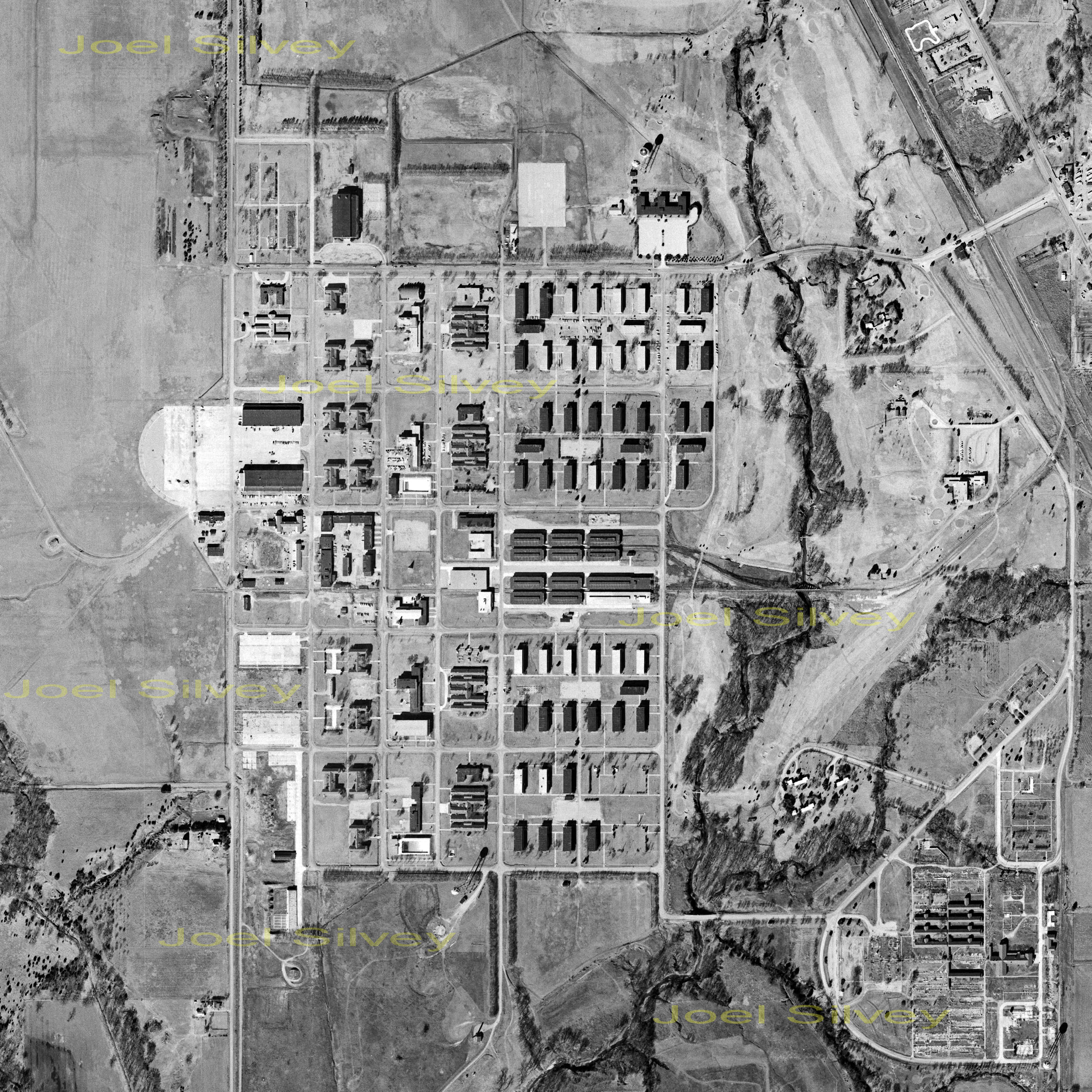
NATTC 1962 Aerial
NATTC 1957 Partial Aerial
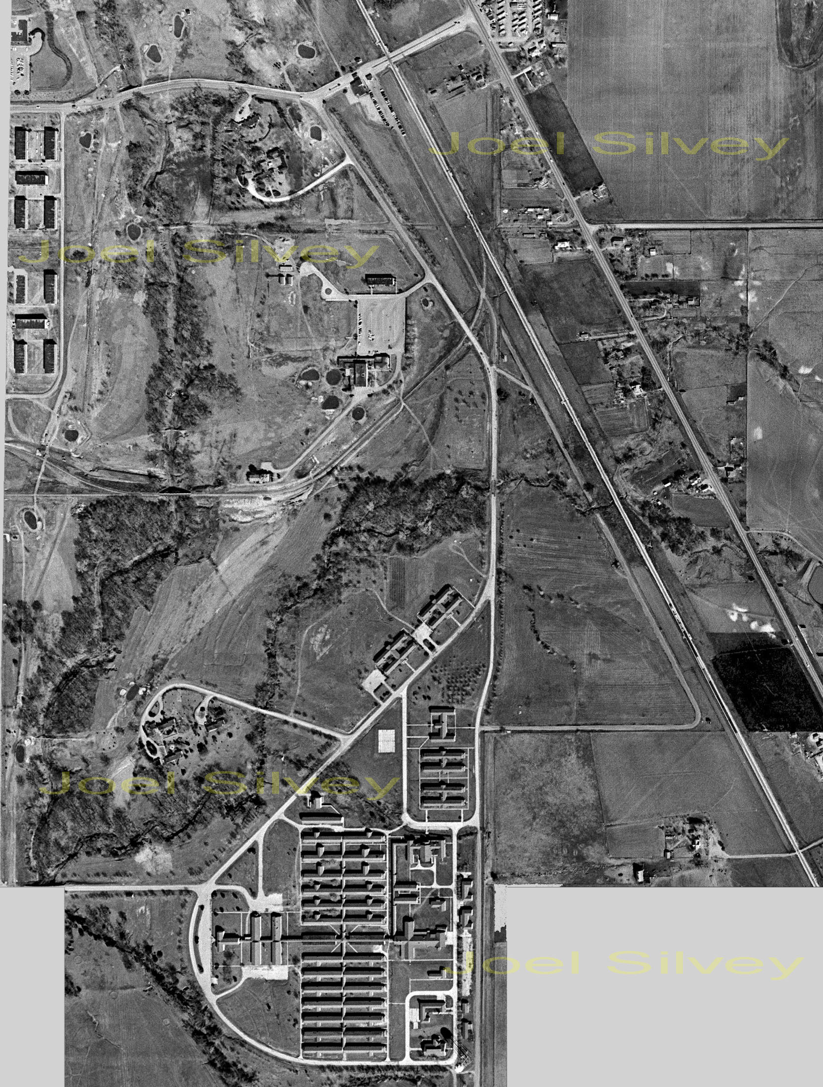
The Navy closed the base down again in 1959 for a final time and classified it as surplus. Until that time aerial photography was not allowed for public consumption, unlike today with modern satellite imagery. The photo on the left shows the base right about the time the property was being divided up and the buildings dimantled. Gernerally speaking the property was divided up between the University of Oklahoma, the City of Norman and public industry. More details about the fate of the bases will be added at some point. The photo on the right shows just the Naval Hospital and the property directly to the north, taken in 1957. The hospital was never reopened after 1946, although the Navy retained ownership over it until after the final base closing.
December 9, 1930
February 15, 1946
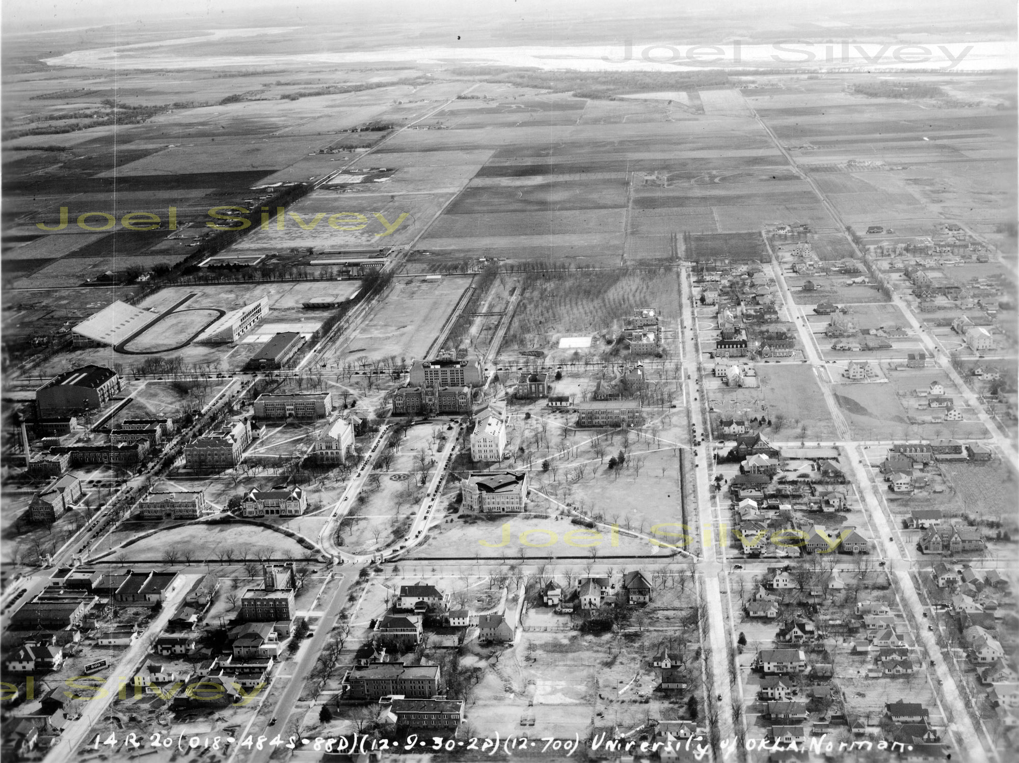
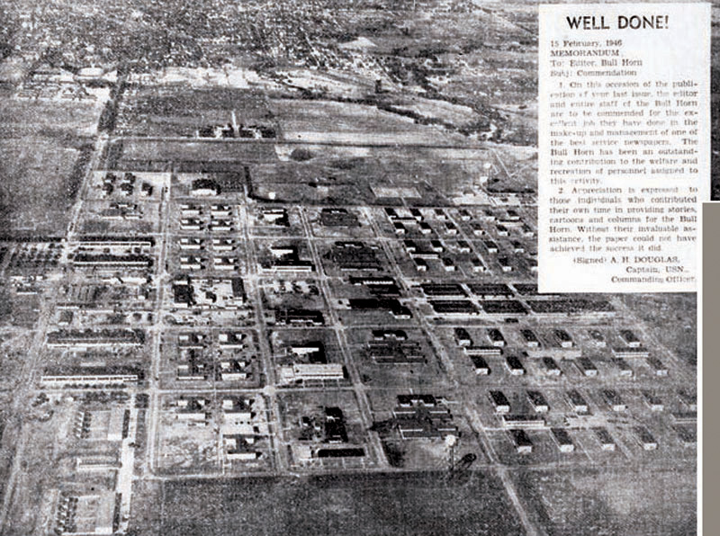
The photo on the left was actually found in the Army's archives. It was taken by them on December 9, 1930 of the University Of Oklahoma looking south all the way to the Canadian River. You will find some more photos taken by them under NORMAN in the drop down menu. There is no connection between this photo and NATTC. But it is a very high resolution photo that shows what was there prior to the building of the training school. The photo on the right was taken from the last issue of the Bull Horn, February 15, 1946. Looking north it shows what NATTC looked like during World War II. At the moment this is the best resolution I have acquired of this photo. Should anyone have a better copy please consider sharing it with this website.
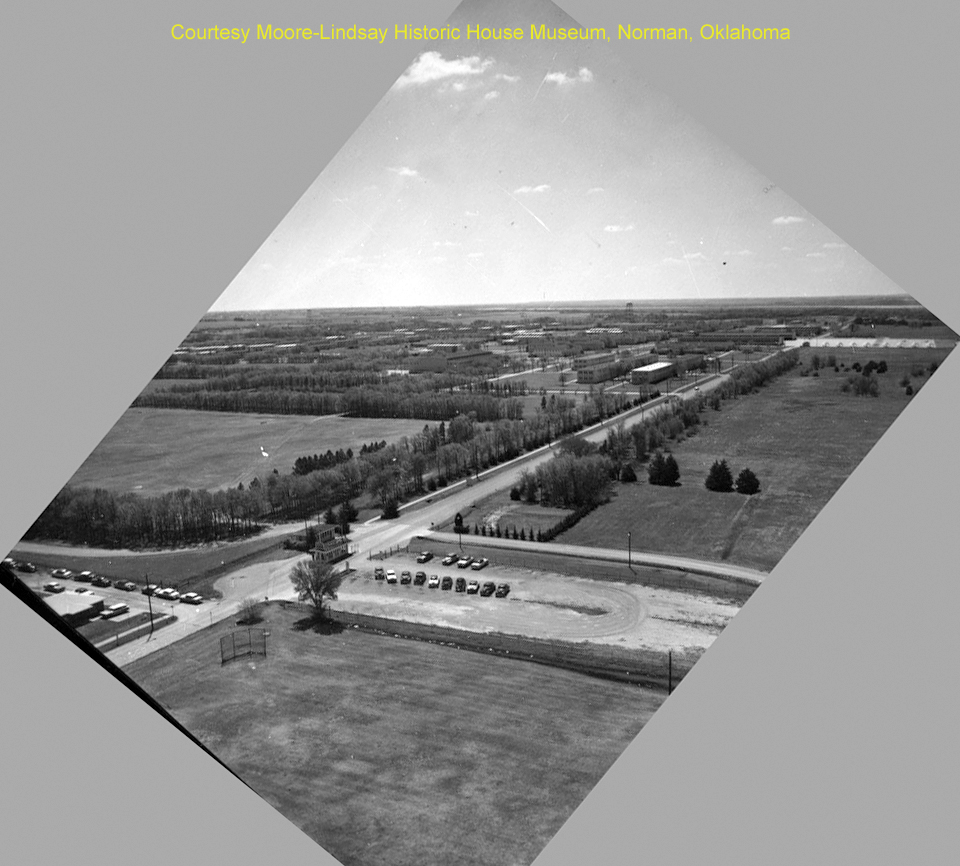
NATTC 1951 Aerial
NATTC North Gate (Jenkins)
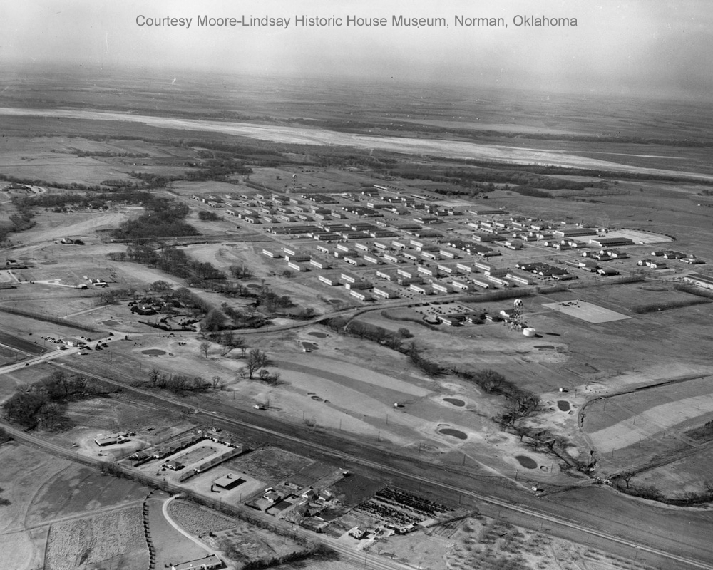
The photo on the left is currently the best aerial photo acquired by this website. While the exact date taken is unknown I believe it to be about 1951. The University Of Oklahoma built their golf course on the Navy's property and opened it in 1951. This photo appears to be the official opening photo of the golf course in 1951, just prior to the Navy reactivating the base. The photo on the right is of the North Gate or otherwise known as Jenkin's Gate. It was taken during the 1950s when the base was reactivated the second time. It was taken at an odd angle thus making it necessary to rotate the photo for web viewing.